Blencathra
Blencathra is also known as Saddleback and consists of 6 separate tops, the highest of which, Hallsfel Top, reaches 2847 feet. A footpath starts behind the Inn at Scales. It is steep at first but soon becomes an easier climb. The path should be followed for about one and a half miles, until a fast-flowing mountain stream crosses the path. After climbing the hillside on the left of the path, keeping the stream on the right, the walker reaches Scales tarn. The easier route winds around the side of the fell to the left of the tarn, just making for the top of the hill.
The other route can be a little hazardous and should not be attempted in bad weather. It entails leaving the tarn at its outlet and climbing north up the grassy slope. This path soon reaches the narrow Sharp Edge. It is not a great distance across the edge, but may require some cautious scrambling. The summit is not far from here.
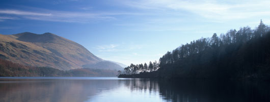
Saddleback offers a lovely view encompassing Thirlmere, Derwentwater and the Helvellyn Range. A return route across the top of the fells in the direction of Derwentwater passes Knowe Crags and eventually passes through Brundholme Woods. There are good views over the River Greta towards Keswick.
Grasmoor
There is a splendid view of Loweswater, Crummock and Buttermere from the 2791 feet high summit of Grasmoor. This peak can be approached from Sand hill, where there is an interesting ridge walk overlooking the valley below Hobcarton Crags. Other peaks in the area are Eels Crags and Causey Pike, both offering impressive views.
Perhaps the most straightforward ascent of Grasmoor is from Lanthwaite Green over Gaskill Gill. The path rises round the end of Whiteside and then continues up the gill, following the beck for while before crossing it and climbing to the summit. The last part of the climb is quite steep. The summit is fairly flat and there is the good view mentioned before from the Crummock side of the summit. It is possible to descend to the Buttermere Valley down Wandope, Whiteless Pike and Blake Rigg.
Great Calva
The slopes of cone-shaped, 2265 high Great Calva are rather stark and bare, mainly due to heather fires. This is particularly the case on the southern slopes. From the summit there is a view of the Glenderaterra Valley towards the Thirlmere Gap. There is a route down towards Little Calva, but it is extremely boggy and hard walking, hardly worth the effort as Little Calva has little to recommend it. There is a good view of Skiddaw from the stony summit of Great Calva.
Grisedale Pike
To climb the 2593 feet high Grisedale Pike, start from the village of Braithwaite. In the angle between the Whinlatter and Coledale Passes is a footpath up to Kinn. Although steep at first, the path levels out a little and the climb is not difficult. The way to the summit is well-marked.
High Pike
There is a great view of Lake Windermere from the 2159 feet high summit of High Pike.
Skiddaw
To me, Skiddaw will always mean Herries country, for it is around here that the Herries Chronicles, novels by Hugh Walpole, are set. The 3054 feet mountain is one of the best loved in the area and is best approached from Keswick station. Just beyond the station, the Bassenthwaite road joins another road and shortly after this Spooney Green Lane, a rough track, branches off to the right. Following this track eventually leads to another track which in turn leads up the long climb of Jenkins Hill. A good track leads from here to the summit of the Lake District’s fourth highest mountain.
The view from the top encompasses Derwentwater, the Solway, Scotland and the Isle of Man. Many more of the popular peaks can be seen but are best viewed from some of the lower elevations such as nearby Lonscale. The remains of Skiddaw Forest are to the east and it is possible to descend Skiddaw by this route, passing Dash Falls and eventually arriving in Bassenthwaite village.